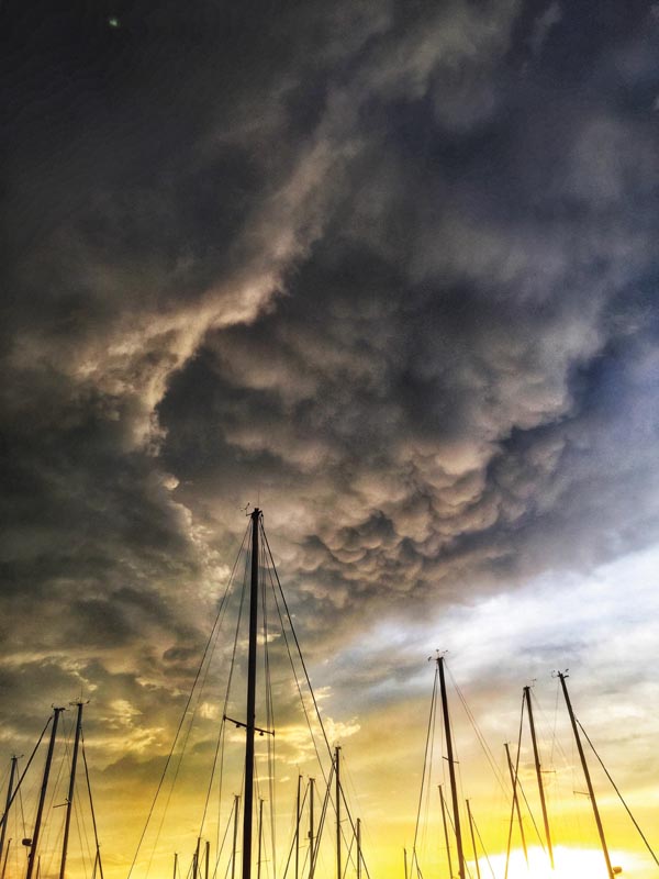
Few things are more important to sailors than the weather
The weather affects our day-to-day decisions as well as our long-term planning in profound ways. As the climate changes, so too will the weather—and how we adapt to it. I spoke with Dr. Adam Burnett, a professor of geography at Colgate University and an expert in midlatitude climatology, about how climate change might impact hurricanes, thunderstorms, and other extreme weather events in the Chesapeake Bay.

How does climate change impact severe weather?
Hurricanes, cyclones, and thunderstorms are complex systems. They’re like a cake recipe—they need multiple ingredients in the right amounts to form the right way. One ingredient that will be impacted by climate change is available energy. According to Burnett, “Hurricanes derive all of their energy from the condensation of water vapor. The more water vapor that exists in the atmosphere, the more potential energy exists in the atmosphere to fuel stronger hurricanes and other storms.”
In a warmer world, science suggests that there will be more evaporation because the atmosphere and the oceans will be warmer, which will lead to more water vapor in the atmosphere and more potential energy that could fuel stronger hurricanes.
“However, like everything, this is not clean-cut,” Burnett elaborated. “Research has shown that the overall number of hurricanes has not been increasing in recent years, but the number of strong hurricanes, Categories 3, 4, and 5, has been increasing.”
Research is ongoing to determine whether or not hurricanes will become more frequent, but there is a consensus that hurricanes will likely become stronger. This could mean that the overall number of hurricanes might remain about the same, but that a higher proportion of them might be Category 3, 4, and 5 storms.
There is less research into the effect that climate change will have on other types of severe storms, such as nor’easters and other cyclones, but Burnett highlighted that their paths may shift closer to the poles. The energy for these storms comes from the difference in temperature between the poles and the midlatitudes, and as the Arctic warms faster than regions further south, the border between polar and midlatitude air masses will shift northward. What exactly this means for the Chesapeake Bay is still unclear, but it is worth paying attention to ongoing research on the topic.
“Thunderstorms are also strongly attached to the amount of energy available in the environment. If you have warm conditions and you have water vapor in the atmosphere, you have a keg of dynamite ready to go off,” said Burnett.
Warm and humid conditions create an unstable atmosphere, which is what thunderstorms thrive on. “Once an atmosphere is unstable and begins to move vertically, pockets of air move up, they cool, they condense, and energy is released,” Burnett said.
With climate change, the Bay will likely experience more hot and humid days. Burnett stated, “Warmer and more humid conditions are always going to yield increasing thunderstorm activity. I think that almost everyone [in the climate community] is of the mind that the basic thunderstorm is going to become more common as global temperatures increase.”
What can communities do to prepare?
Hurricanes, cyclones, thunderstorms, and other extreme weather can affect coastal communities like the Bay in specific ways. Besides heavy wind and rain, coastal flooding caused by sudden downpours, storm surges, and specific wind conditions is one of the most notable impacts, and sea level rise can exacerbate these flooding events. Burnett mentioned that building protective barriers, such as seawalls, is a good start for adapting to these changing conditions. Long-term solutions may be found in wetland protection, upgrading existing infrastructure, and reducing the amount of impermeable surfaces (such as concrete and asphalt) that contribute to runoff that helps produce flooding.
Five weather tips for sailors
The only way to reduce the impacts of increasing severe weather is to do your part to help mitigate climate change. Decrease your carbon footprint by driving less, conserving energy, and reducing your consumption and waste. Some impacts, however, are already inevitable. To help prepare you and your boat for a world with more and stronger storms, make a plan for what you will do when they happen:
- Have extra docklines and chafe gear available, and be ready to double them up.
- Keep your decks organized so that you can move loose gear down below or off the boat quickly. Consider where you might want to move your boat in the event of a hurricane, or if your current marina is protected enough.
- When choosing a marina, take a look at its infrastructure: are the docks well-built? Are neighboring boats well taken care of, with organized decks and well-maintained docklines? Even if your boat is secure, you don’t want another boat breaking free and colliding with yours in a storm.
- Know local weather patterns, check the weather before you go, and learn what to look for to tell if a storm is coming.
- Learn more at the two-hour webinar “Chesapeake Thunderstorms: Essential Skills” on July 26, 2022 from 7-9 p.m. Register here.
More resources
To learn more about climate and weather, Burnett recommends visiting NOAA's website, which has great resources about how hurricanes and other storms work, what to look out for, and what to do in the event of a storm or emergency.
by Kelsey Bonham
About the author: Chesapeake Bay sailor Kelsey Bonham recently graduated from Colgate University with a degree in environmental geography, studying the complex relationships between people and our enviornment.


